
![]() Retour à l' Aperçu général, cliquez ici.
Retour à l' Aperçu général, cliquez ici.
![]() Back to the general overview, click here.
Back to the general overview, click here.
 |
Van Olympic Marina ( Sounio-Lavrio ) naar Horto ( zuid-Pilion)lente 2013De Olympic Marina ( Sounio-Lavrio ) à Horto ( sud-Pilion)printemps 2013From Olympic Marina ( Sounio-Lavrio ) to Horto ( south-Pilion )spring 2013 |
||
From Nieuwpoort (B) to Greece (2007-2008) and Horto (2009), and back to Lefkas; from Lefkas Marina to Olympic Marina (Sounio-Lavrio) by skipper (2012) |
|||
|
|||
From Olympic Marina (Sounio-Lavrio) to Horto (2013) |

[ map: GNTO free map: www.gnto.gr ]
Pagina uitsluitend in Engelse versie.
![]() Page en version anglaise exclusivement.
Page en version anglaise exclusivement.
Olympic Marina
Windfinder forecast for Olympic Marina (Sounio-Lavrio) |
 |
Olympic Marina - where Nehalinnia has wintered - mid-May. We launch the boat on May 21st
|
||
|
 |
 |
|||
23.05.13 A nice alternative while we are preparing the boot in Olympic Marina: a short trip to the deserted Sounio-anchorage - 2 NM more south - during windy days - 5 to 7 - from the South. |
From Olympic Marina to Chalkida
 |
|
25.05.13 Finally the wind is easing; for tomorrow SW 2 to 4, locally 5 in the afternoon, is forecasted. We decide to leave in the early morning , heading for Chalkida ( Chalkis ), 60 NM northwest from here. |
26.05.13 We leave Olympic Marina at 06H30 LT on this sunny Sunday. No wind and a smooth sea. At 07H15 we just have passed the harbour Lavrio. The bearing to our first waypoint, 0,5NM off cape Drakonera at 28 NM - 3NM north of Marathonas, is now 000°. |
 |
|
|
|
It's close to 9 a.m. when we approach Porto Rafti, situated behind the as an animal looking rock. The anchorage Porto Rafti is mentioned in the pilots as an all round shelter. The name rafti means tailor, according to a statue of a tailor found here. |
||||

 |
 |
On starboard the south of Evia, and Kafireas Strait known as one of the most windy seas in Greece, specially when a strong meltemi is blowing. The coast of Attica - Athens is nearby - is not particularly nice as there are a lot of small villages and small towns, harbours like Lavrion and more northerly Rafina, holiday resorts for the people of the crowded city of large-Athens. For stability we have hoisted the main sail and on the engine we run around 6kn on the log, 5 to 5.5 kn s.o.g. We estimate a trip of 12 hours. Around 10 a.m. there is some, but irregular, wind - E-ly 8-12 kn (app.); we try to set the H.A. jib ( we expect W-wind 4-5 closer to Chalkida ) but after a while there is less wind again. 10H30 Rafina is on port, no wind at all.
 |
||
12H12 LT Close to our 1st waypoint 38°10' 000N 024°05'500E : looking to the SE, Evvia and at the far right Kafireas Strait |
11H15 Suddenly we get 15 kn wind, and is still increasing as we still are sailing more to the north part of the Petalion gulf where the passage between the mainland, and the island of Evia is becoming narrow, with on one side the capes Marathonas, Drakonera and Ag. Marinas and on the Evia-side cape Strongylo. Small islands - rocks like N.Dipsa ( 2,5 NM east of cape Marathonas ), N Petousi, Ag. Andreas and Styra close to Evia. Between cape Ag. Marianas en the rock islands Verdougia - off of Agia Marinas - the passage is only 0.7 NM wide. We have two reefs in the mainsail, no jib as we are running before the wind and we want to preserve the progress.
12H45 After cape Agia Marinas the wind is irregular from abeam to free, our course is 315°for about 1NM. 13H00 the wind is easing, bearing 295° to our successive waypoints along the mainland coast of the S-Evvoikos kolpos (gulf). 13H40 no wind anymore. 13H45 increasing head wind, first close, over port. On the numerous beaches, screens of cars are shining in the sun: it's Sunday, and for the Greeks who are living in the vicinity of water, nothings will hold them from going to the paralia. A lot of resorts too along the mainland coast while the coast of the island of Evia is less built. 16H00 Our last waypoint before the entrance of the narrow and complicated navigation in the strait to Chalkida is at 5.5NM, bearing 290°. We cross the ferry line from Skala Oropos to Eretria on Evia in between two ferries without problems ( it was more stressing in 2009 ). The head wind is still increasing to 27 and 30 kn, short waves are breaking on the bow and flow over the roof but our cockpit behind the sprayhood remains dry.
17H10 Approaching Steno ( = strait ) Avlidos, the narrow access to Chalkida, at about 5 NM.
 |
 |
|||
Chalkida, the new bridge between the mainland and and the island : |
Arrival at Chalkida, main town of the island ( on the picture from the middle to the right; the S-harbour is on the right, the old bridge ,where we have to pass - only 1 night-opening - in the middle ) |
A succession of narrow passages - not so best marked by buoys and less visible in the late afternoon sun - alternate with larger waters, some are a kind of docks for boatyards or for other outdated and mostly closed factories.
18H10 Situated just before the new bridge, the cement factory has now finished all activity, leaving about two thousand unemployed more without future in this already terribly affected region - a comparable situation in many parts of Greece!
Chalkida
18H45 Berthing on the visitors pontoon. The two other pontoons, concessions of two different clubs, are full crowded by boats - mainly sailing boats - quite all unoccupied on this early Sunday evening, a lot since a long time ( consequence of the crisis, if we believe our complaining Greek neighbour in Olympic Marina ). Squeezed between a nice Dutch sailing boat - friendly neighbours! - and a huge yacht under Maltese flag we will stay a few days here as the wind in the north-Evvoikos gulf is not favourable for the NW course to Limni and Orei. The Promenade along the banks is nice and very lively, with numerous big cafes. On the big yacht a crew is doing maintenance works on the teak causing a lot of noise a large part of the morning and the early afternoon. The harbour - the three new pontoons finished since our passage in 2009 when the works where going on - has no charm but it is a rather good shelter and the water and electricity supply works ( prepay card ) and that's real luxury in Greek harbours, where disorganisation is law! A part of the visitors berths are occupied by 4 or 6 sailing boats under maintained for their foreign owners by a Frenchman, with who we have to come to terms for the 220V supplies, as the most supplies provide 380 - another bad calculation in this new marina (!) perhaps expecting numerous big yachts, while most of the visiting boats are sailing boats! |
 |
Chalkida / Chalkis, see also http://www.army.gr/html/GR_Army/sxoles/spz/ISTORIA_PERIOXHS_EN.html , is rather busy, with a lot of traffic.
|
The road from the harbour to town centre is very dangerous: the about 50 cm small footpath going around the military base just offers the passage for one person, while the intense traffic is passing close in the curve, at high speed. This is of course (!) an exemple of the perfect way (!?! ) to keep foreign water tourism in the Chalkida and to "charm" the visitors, tourism that seems to be, more and more, the only one alternative for the absolute decline of Greek consumption! But it seems that the municipality is not understanding anything of the changed situation and that the narrow-minded and lazy bureaucracy will obstruct the so necessary ( but in fact, many times, little ) adaptations, like everywhere in Greece, besides. |

For the bridge-passage we have to pay the toll in the port police office ( in the narrow street, on the right in the beginning of the street, ahead/right on the big roundabout in the front of the bridge ) submitting the boat papers and the crew-list. Chalkis Old bridge opens only one time in the night at slack when the current between S- and N-Evvoikos stops running during about 15 minutes before the turn, and at least for two boats. The hour of slack is not easily predictable so we have to stay stand-by on VHF 12 for the call of the port police to proceed.
Read also more about the current-phenomenon: http://www.negroponte2010.gr/en/chalkida/paliroiko-fainomeno.html
Practical info Chalkida S-harbour: harbour fees: 0,50 euro/ m LOA, prepaid card W&E ( small office entrance ) ; 2 showers, 1 toilet, var. opening hours, ask office ( or call Chrisa 2221063121 or 6974029849 if not in office ( 11am-16pm) / or out off hours, very helpful; colleague at some times present, security men in the (whole ?) night
 |
28.05.13 Chalkida. We are now already three days in Chalkida waiting for the right weather conditions to reach, after the passage of the bridge, the nice village of Limni, 25 NM further north-west. The small harbour of Limni is already very uncomfortable with southerly wind even when it's moderate - 4 to 5. So for Tuesday the forecasted conditions are not favourable, nor for Wednesday as northerly winds 4 to 5 - opposite to our course - will blow the largest part of the day. The seas in the Evoikos kolpos are very short and will make progression impossible for a small longkeeler like our boat, with only a 10 hp engine. Tacking in those short seas over 25 NM is not an option as the distance will be double! On Tuesday evening three yachts decide to pass the bridge heading to the north, despite the for Wednesday 29th forecasted Nly wind - in our opinion not the right choice, as also along the Chalkis N-quay the night will be choppy. In the evening the wind is increasing and dark clouds bring some rain, forcing us as we are invited for a drink on our neighbours boat to stay in the saloon. |
||
detail Poseidon N-Aegean 201305290900 |
29.05.13 Chalkida. Tomorrow, Thursday, we will get W3, becoming E2 in the afternoon, according the Poseidon and the meteo.gr forecasts. We decide to pass the bridge this evening. In the late afternoon we go to the port police office to pay the passage fees. In the small office five servants are eating various take-away food. Three of them do not mind us absorbed as they are by their feast - roasted chicken legs, stuffed pies and other nice things -, but two women friendly help us for fulfil the liability. The toll rate for our small boat is 18,77 euro.
 |
Heaving prepared the boat, we leave our berth and make fast alongside a Dutch sailing boat at the head of the pontoon, well assisted for the manoeuvre by the owners as small buoys and lazy lines make the approach little complicated. By that way it will be more easy this night to leave the harbour for the bridge passage now that we have left our tiny berth and that we will not have to raise our stern anchor at night, squeezed by the enormous fenders of the big yacht, in a harbour full of lazy lines and other dangerous junk, common in Greek harbours, like old chains, cables etc. At 10pm we start watching out on VHF ch.12. It's nearly 00.30 am when the port authority calls us for proceeding to the waiting area close to the bridge, on the mainland side, just under the railway station. |
00H45 the bridge opens. First two sailing boats go through the small passage as the lights are G-W-G. When the lights change in R-W-R we pass as quickly as our 10 hp engine allows. A little later it's the turn of two big ships, a sailing boat and a motor yacht. The sequence for the passage is little bit confused as in the afternoon we were told that we had to pass before the two big ships - because we should manoeuvre the passage quicker - while it seems that the bridge authority means the contrary and because we get no response to our clarification and confirmation query we decide to proceed immediately as the lights for the S-to-N passage were on. The fairway is free and no other ship was approaching. We have also an urgent reason to pass as soon as possible: when proceeding just before the opening of the bridge, we noticed a high charge on the alternator, up to 20A - a lot for a small, by a Sterling regulator managed alternator; so after a quick check in the engine compartment and fearing possible overheating problems if we wait more, we go ahead, pass the narrow gate and, immediately leaving the channel - keeping free from the shallow water on starboard, we point the mooring area on the quay in front of the dimarchio ( = the town hall ) ... where two of the three boats that passed the bridge yesterday, are still waiting, after a choppy night and day on an uncomfortable quay, favourable wind conditions!
At 01H30, tired after this little stressing night, we go for a short sleep ...
From Chalkida to Limni
30.05.13 06H30 A pale sun is shining through the mist: little humid patches on the teak deck, the roof is more wet, little slippery too, but no comparison with the early morning in the North, when we were awaking for a sailing from Fécamp to Saint-Vaast-la-Hougue, or from Jersey to Lézardrieux ... But here the sky is blue and the day will be nice, and all will dry quickly! After a rapid check of the weather forecast, a cup of coffee - prepared yesterday but still nice hot in the thermos flask - and some bread ( gluten free for Eric ) with cheese, strawberry and bitter orange marmalade, while already preparing the departure for Limni - we had a shower yesterday afternoon before leaving our berth.
07H20 We leave Chalkis, not less happy that our stay here, and the passage of the bridge occurred relatively fluently. It seems that from now we really leave Lefkas and the Ionian, that the aborted delivery of Nehalinnia by the hired skipper and the 11,5 months long stay of our boat on the dusty hard in Olympic Marina - stressing for that reason - and the irrational, little foolish doubt about the possibility of sailing the boat to Horto are behind us. 07H45 Nehalinnia is on course: 320° for about 23 miles, speed 5.5 - SOG 5.3, there is no wind, the sea is calm and the visibility still moderate. A small fishing boat, nearby, is slowly overtaking. A little, sparing salute. Both, we go our own way. Little minutes later, we cross his wake. We hoist the main sail: it gives us more stability, even in absolute calm conditions, or when a when a passing boat makes some disturbance. Every hour or when arrival at a waypoint or passing a sea- day- or landmark, Eric reports our position on the chart like he always did since we are sailing. Neither the computer navigation nor the plotter ( we have since Menton in the late winter of 2008 ), have changed this usage. 09H30 Wind (app. ) is now NNE 7kn. Our progression is good and one moment we are hesitating if we should continue till Loutra Aidipsou, making our sailing for to morrow to Orei 13NM shorter. The memory of our passage in Loutra in 2009 is not so good: less space, a stinking waste bin on the quay and the whole night loud chattering anglers quite near to our boat; besides, we have found Loutra Aidipsou not very charming, and we had there no good taverna. So, we maintain Limni, that we remember as a charming place, for today's stop. 10H00 The Kandili is the highest mountain of Evia (1225 m) and its foothills shape a large part of the coast along the Vorios (= Northern) Evoikos Kolpos. The Elias pilot mentions the strong gusts in this area and gives the unmistakable instruction Never approach mount Kandili when strong N-NE winds blow!. |
 |
10H30 Limni is now at 5.5 NM, our course 325°.
11H20 At 1,2NM of the small harbour we notice a sudden light WSW swell, little uncomfortable to lower the main, and to prepare fenders and mooring lines. ..
11H50 Nehalinnia is moored alongside the outside quay under the wall, bow to the entrance, just still inside the inner part of the harbour,in front of a nice UK sailing boat with a nice teak deck and wooden roof. The friendly crew gave assistance for the manoeuvre and later on we have the opportunity to become better acquainted. Except from the first part of the quay along the wall the small harbour is full - manoeuvring is very difficult, Kaat just had enough space to realise a nice 180° reversing - about ten local sailing boats, four fishing boats, and a lot of small boats and launches, a few ribs.
 |
 |
|||
Approaching Limni |
Limni, Nehalinnia alongside the outer quay, bow to the entrance |
After lunch we go for a swim and a shower on the beach. An ice cream on the terrace of the zacharoplastio ( = pastry-shop ) near the harbour completes the holiday-feeling. Meanwhile there is little more wind, but a lot more swell, which will be a large part of the night.
In the late evening - after preparing the coffee for next morning - we go eating out at the Seven-Winds taverna.
 |
 |
|||
Just outside of Limni, the ruins of a cafe-bar, were in 2009 we went for a drink before dinner in a taverna little higher on the road In between the destroyed cafe and the taverna, there is a beach accessible by a path and stairs, well marked by a panel, where we went this year for a swimmy and where is a (still) working shower ...
|
||||
Limni, storms can be heavy here, as also there is a lack of maintenance; in the background, the harbour, and the village; just behind the slip there was a shower in 2009, as many people went on this beach there for a swim, the shower is still there but no water is running out; close to this there is a water sports centre ( open sailing boats etc ) that belongs to the municipality |
|
From Limni to Orei
31.05.13 07H30 The swell went completely down when the sun came up but now when we are hoisting the mainsail and taking away the fenders and mooring lines just outside of the harbour, the sea again is not oily-flat. There is not much wind forecasted for the north part of the North Evoikos: SW to W 2 to 3, for a time NE 1 to 2 off Loutra Aidipsou, around midday SW to W 2 south of the narrow passage - less than 0,1NM - between Akra ( = cape ) Lichada - a small but stretched sandy isthmus on the Evia-side, also known as A. Kunaion - and A. Monolia on the same named small island. Our course will first be W and in the passage NW and N. In the Diavlos ( =canal ) Orioon we will sail a ENE course, the forecasted wind should be W-SW 4 to 3 decreasing 2. In the evening and the first part of the night more wind: W 4.
 |
Our first waypoint is 0,50 NM SE of Akra Lichada, at 22NM.
10H15 We are approaching the ferry line from Arkitsa on the mainland to Loutra Aidipsou. On each side we have a ferry crossing our course.
10H20 Both ferry's pass behind us.
 |
||||
 |
||||
The ferries are passing behind us |
||||
The ferry line from Arkitsa on the mainland to Loutra Aidipsou, right on in the background |
|
The coast of Evia here is not deserted: there are a lot of villages, houses and resorts along the side, and on the lower parts of the hills. On the mainland too we can discover small villages and holiday houses.
12H00 Akra Lichada at 1NM. The detailed chart of our Elias-pilot is next to our plotter. The currents in the Poros ( = channel ) Lichaidon can be very heavy: the N-going - on the side of N. Monolia and the strongest makes a curve around Akra Lichada and carry off course in the direction of the shoal extending north on the E-side of N. Monolia. We have the warnings of the pilot in mind but we expect less current now.
12H10 We have now Akra Lichada on SB and notice SOG 6kn.
 |
 |
|||
Approaching Akra Lichada; in the middle on the background the Monolia island; the narrow passage between the island and A. Lichada is not visible |
Nehalinnia just having passed Akra Lichada, in a confused see |
12H20 The wind (app.) is increasing to 20 kn and is here, on the north side of the strait, little opposite to the current. This is in these narrow area enough to create confused seas, short waves brake on the bow on port and splash on the roof, leaving salty patches when quickly drying up in the midday sun. We can fully appreciate now that we have in time reefed our mainsail so that we have less worries when our small boat is little swerving when an wave is coming from an unexpected side.
12H40 Nehalinnia is now on a NE-ly course, heading off of A.( = Akra = cape) Vasilinas, running with the favourable current more than 6 kn. In no time we are running wind free in a still confused sea.
 |
 |
|||
After the passage of Akra Lichada; the sea is confused as the wind is opposite to the current; we are now on course for Orei, passing first Akra Vasilinas, in the middle on the background |
The north coast of Evia is for the most part not built, and there are less villages, but a lot of fish farms in the numerous small bays |
13H30 We are at 5NM from the ferry line Glyfa - Agiokampos, course 065°, speed 5,9 kn, SOG 6,1 kn, back wind (app) 6kn over SB.
The traffic situation can change rapidly as in a few minutes a ferry can start to cross Orei channel and our speed is completely inoperative in such a situation as these ferry's are fast. So it's important to keep course and speed so that the captain on the ferry can adjust his course on a clear situation.
14H00 No ferry making way to cross Orei channel, as we can see.
14H20 A ferry coming from Glyfa starts crossing for Agiokampos. We know that his course from the middle of the channel to Agiokampos will be around 095°. Soon it appears that there will be no problem: he will pass 0,3 NM behind us.
14H35 The bearing to the Orei reef buoy is 000°: time to set course 090° for Orei at 1,2 NM.
 |
15H00 After 38 NM , we moore on the north quay, right of four fishing boats moored two by two alongside. After we have carefully checked it we have taken a lazy line : in 2009 we had to use our stern anchor but now seeing all those lines and small buoys and other rubbish in the water we prefer to take no risk for a trapped anchor. These lazy lines, a lot in bad condition - or cut off! - were probably put for summer-long stay, as there is, as common in Greek harbours no trace of any organisation. In 2009 the ( new) pillars for water and electricity supply were not yet operating due to a software problem with the prepaid cards, now in 2013, the supply is out of use due to a lack of prepaid cards in the supermarket ( behind the church ) - where the very friendly owners are absolutely desperate - : that there are no cards should by the consequence of a local police war, as we are told. The south breakwater is now rebuild as a quay - with pillars for water and power supply - quite full occupied by a charter base. |
In the village a fuel station is operating (again after an us reported interruption last year ?!). In general we can say that there are no real changes, no real improvements and that the general feeling is certainly not that of dynamism!
On the large beach nearby ( in 2009 it was every morning cleaned ... ) a few showers are still working, a use that we make after a swim in the rather cool waters of the Orei channel, before going eating out at sunset. The meal is basic but not bad: boiled vegetables - chorta, vlita, courgette and beetroot, tsaziki and two nice plates of sardines.
 |
 |
|||
Orei, on the north quay, looking to the beach and Oros ( = mountain) Tragonoumi (638 m) on the mainland. The Trikeri channel, we have to cross to-morrow is on the right, but out of the picture. |
In the early evening, as the sun is declining, the fisher boats are leaving the harbour for a night fishing in the Pagasitikos kolpos; on board usually about 10 fishermen - living on board! -, mainly Egyptians or north-africans, while the captain is Greek. |
In the night the 38' neighbouring - rented - sailing boat lost - by a gust - his too short and too thin lazy line, compelling us, the too inexperienced crew and the crew of an other sailing boat to uncomfortable manoeuvres to keep our boat free from this to big charter boat. Finally we could only go back sleeping when - after complicated and clumsy manoeuvres - they succeeded - after a lot of tries - in dropping their anchor and moored again, with the help of many hands.
From Orei to Horto
01.06.13 According the forecast the wind that had freshening in the night will decrease in the late morning. In the Diavlos ( = canal) Trikeri and the entrance of the Pagasitikos kolpos ( = gulf) even a moderate wind can create a uncomfortable situation, with higher waves than expected as the canal is narrow, the coast relief high and the currents significant. Specially, wind opposite to current can make the progression of a small boat difficult. Different friends of us were surprised on bigger boats than ours by the sea in this area. We knows also that when de wind is decreasing, the sea also is quickly easing.
So, this morning no early start, but waiting for the moderating wind, like in the north sailors are waiting for the tide!
10H30 Kaat drops the lazy line and while the mooring ropes on the bow are slipping from the bollards. Nehalinnia, little taken by the propeller walk, has to be execute in the narrow space a reversing manoeuvre to avoid the little buoys and lines floating around. Just outside the harbour wall we hoist the mainsail and steer a 357°course in direction of the village of Agia Kiriaki, situated on the foot of the hill where the village of Trikeri is conspicuous. We pass close to the NE point of the small Argironisos island where is a Fl 5s light and steer than off A. (= Akra = cape) Stravros and its little N-extended shoal in direction of A. Kavoulia, the south-west point of Trikeri peninsula, also known as the South Pilion region of Magnesia, at the entrance of the Pagasitikos kolpos, where in the north of this gulf, the big city of Volos is situated, from where in mythic times Jason started the quest of the Golden Fleece. When sailing to the East in Diavlos Trikeri, the trip to the Sporades islands - Skiathos, Alonisos and Skopelos, a well known group of islands of the central west Aegean sea - is not long: the SW point of Skiatos lies about is 2,5 NM from the SE point of the South Pilion peninsula.
 |
 |
|||
Having left Orei, on course to the NE point of the small Argironisos island and thereafter we will steer off A. (= Akra = cape) Stravros |
Crossing the Diavlos (= canal) Trikeri , looking to Agia Kiriaki |
 |
12H00 A. Kavoula and its L Fl (3) 20s light close on starboard (SB). We are now heading for A. Kalogeros ( on the peninsula ) and the south of the channel of Trikeri island. From 357°our course is evolving to 055° as we are steering on sight in the narrow areas where small bays are alternating with rocky coastlines following the foot of the hills which constitute the relief of this very nice and still rather well preserved region. |
|||
Approaching the entrance of the Pagasitikos kolpos, A. Kavoula and its L Fl (3) 20s light, is the south-west point of Trikeri peninsula, also known as the South Pilion region of Magnesia |
|
On the island, around the small harbour of Palio Trikeri, three tavernas, a kind of small supermarket, little further a small hotel. Few houses. A sailing boat seeing our boat, hastens to the small quay, where already two boats are moored. Then, just more to the north, a pretty well protected anchorage. Five or six sailing boats, a nice motor yacht, lines on land. A charter boat, coming from the Sunsail-base situated at the entrance of Ormos (= bay) Vathoudi, is crossing our course line.
13H30 Kaat is steering a 077° course to Horto. The village, with its small bridge over the torrent, coming from the hills under the village of Metochi, and its nice fountain, is now visible by binoculars. Kaat calls Eirini and Stathis our friends, owners - with Statis parents - of restaurant Evochia and Nicolas hotel to announce our soon arrival. They have kept up with the transfer of our boat almost daily!
At 14H30 we realise our aim: bringing Nehalinnia back to Horto, close to the house with the nice garden, where we like to spend a large part of the year. The voyage in 2009 was in this incomplete that we had at the end of August to sail back to Lefkas, as we had at that moment for the boat and for us no other solution to stay here.
 |
Now we hope to realise the full project that we have imagined in 1994: sailing with our own boat in the Pagasitikos kolpos as we did that year with a rented boat and three holidays long with our small inflatable ... which name was expressing our hope: Espoir!
 |
||
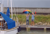
| Sunday evening, the 1st of June, on board, we are looking to the sunset ... |
Olympic Marina - Horto: 145 NM
10-feb-19
|
Terug naar hoofdpagina LOGBOEK.
Terug naar pagina Griekenland 7: lente en zomer 2013.
![]() Retour à la page Greece 7: printemps et été 2013.
Retour à la page Greece 7: printemps et été 2013.
![]() Back to the page Greece 7: spring and summer 2013.
Back to the page Greece 7: spring and summer 2013.